APAS Organises “APAS BeiDou Navigation Satellite System Technologies Forum” Exploring Applications of the BeiDou Navigation Satellite System to Build Hong Kong into an Innovative and Sustainable Smart City
(Hong Kong, 18 September 2023) The Automotive Platforms and Application Systems R&D Centre (APAS) successfully held the “APAS BeiDou Navigation Satellite System Technologies Forum” (the Forum) to explore the opportunities and challenges of applying the BeiDou Navigation Satellite System (the BDS) in smart cities and the digital economy, as well as investigate various application scenarios. Together, we strive to build Hong Kong into an innovative and sustainable smart city, enhancing its competitiveness in international innovation and technology as well as the high-quality development of the global economy.
The BDS is a satellite navigation system developed by China. It provides global users with all-time, all-weather and high-precision positioning, navigation, and timing services. It has been applied to various industries, including transportation, energy, agriculture, communication, weather, and natural resources. Alongside the United States's Global Positioning System (GPS), Europe's Galileo, and Russia's GLONASS, the BDS is recognised as one of the four major global satellite navigation systems. According to the white paper[1] on the development of China's satellite navigation and positioning service industry published in 2023, the total output value of China's satellite navigation and positioning service industry reached RMB$500.7 billion in 2022, up 6.76% year on year. This reflects the industry's sustained and stable growth, driving demand and investment in technology applications. The BDS is widely adopted in various industries. According to data from the National Development and Reform Commission, BDS-compatible smartphone shipments in the Mainland reached 324 million in 2021, accounting for 94.5% of the total smartphone shipments. Furthermore, the number of transport vehicles installed with the BDS in the Mainland exceeded 7.8 million in 2021.
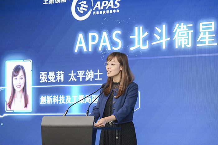
Ms Lillian CHEONG, Under Secretary, Innovation, Technology and Industry of the HKSAR Government, said, “The BeiDou Navigation Satellite System has achieved remarkable accomplishments just 30 years after its development and launch. The HKSAR Government's Common Spatial Data Infrastructure, for instance, receives signals from sources, including the BDS 24/7 to provide the public with an extensive array of geospatial data. I believe that the profound integration of the BDS with emerging technologies like big data and artificial intelligence holds immense potential. I would like to invite you all to leverage the numerous open datasets provided by various Government departments through the ‘Data.GOV.HK’ website and pioneer the development of more applications that benefit both the public and the business community together with the BDS, with a view to expediting the advancement of Hong Kong’s smart city development.”
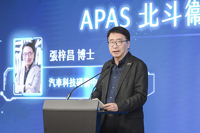
Dr Lawrence CHEUNG, Chief Executive Officer of APAS, said, “To align with the development achievements and future vision of China's BeiDou Navigation Satellite System in the new era, as outlined in the white paper[2] titled ‘China's BeiDou Navigation Satellite System in the New Era’, and to accelerate the BDS towards a new phase development of globalisation, APAS is currently actively exploring the feasibility of integrating the BDS with autonomous driving. By leveraging the high-precision advantage of the BDS in the Asia Pacific region, we aim to facilitate the rapid advancement of the BDS in the automotive sector, thereby further enhancing the precision, safety, and reliability of autonomous driving. Together, we can build an innovative and sustainable smart city.”
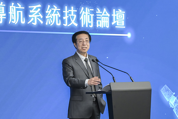
Dr Brian LIN, Center Director, Research and Development Center of Transport Industry of BeiDou Navigation Satellite System Technologies Applications, Ministry of Transportation of the PRC, said, “We lead the world's spatial-temporal Internet of Things big data integrated artificial intelligence cloud platform. From cutting-edge innovative digital infrastructure and digital twin, to chips and algorithms, we have our independent intellectual property rights. We look forward to working with various HKSAR Government departments, education institutions, enterprises and citizens to build Hong Kong into a world-class smart city and make Hong Kong's digital economy and life safer, more reliable and efficient, and sustainable.”
The Forum invited a number of industry experts to deliver presentations, including Dr Jun SHEN, Chief Scientist, Beijing UniStrong Science & Technology Corporation Limited, Dr Ming GE, General Manager, Robotics and Artificial Intelligence Division, Hong Kong Productivity Council, Prof Wu CHEN, Research Institute for Artificial Intelligence of Things, The Hong Kong Polytechnic University, Mr Xiaoping FENG, Vice President, S.F. Holding Co. Limited & Commander in Chief, Ezhou Airport Construction Project, and Mr Clark ZHANG, Director of Portfolio and Marketing, UniStrong TopSci Hong Kong Limited. They shared various topics related to the BDS with over a hundred industry professionals at the event. The topics included understanding the application development of the BDS, its potential applications and impacts on smart city development, as well as case studies sharing to provide insights into the latest development opportunities in the industry.
On the event day, an exhibition was also held to showcase the latest products and services related to the BDS, including intelligent safety helmets, surveying instruments, law enforcement recorders, etc. These allowed participants to have a hands-on experience and gain first-hand knowledge of the applications of the BDS.
APAS aims to accelerate the application and related research and development projects of the BDS in various fields through the Forum. This aligns with the national goal of building a more ubiquitous, integrated, and intelligent comprehensive national positioning, navigation, and timing system with the BDS as core by 2035 and contributes to sharing the achievements of China's BDS infrastructure with the world.
For more information on APAS' services and projects, please visit the website: www.apas.hk/index.php/en/.
[1] China's satellite navigation industry output up 6.76% in 2022
[2] China's BeiDou Navigation Satellite System in the New Era
- Ends -
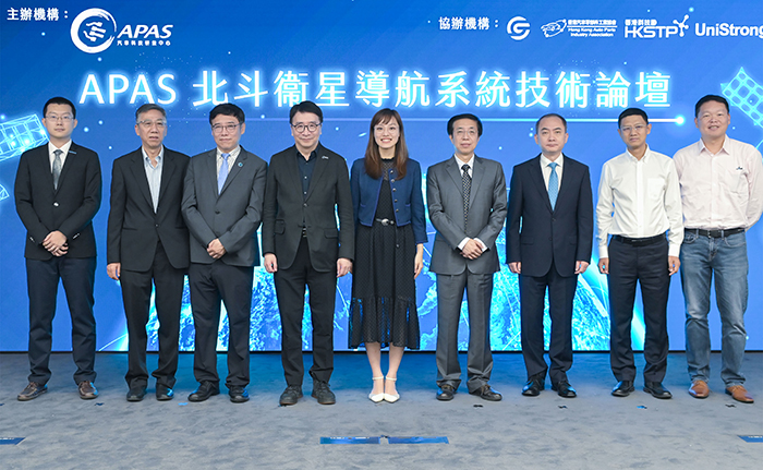
 Ms Lillian CHEONG, Under Secretary, Innovation, Technology and Industry of the HKSAR Government (fifth from left), Dr Lawrence CHEUNG, Chief Executive Officer of APAS (fourth from left), Dr Brian LIN, Center Director, Research and Development Center of Transport Industry of BeiDou Navigation Satellite System Technologies Applications, Ministry of Transportation of the PRC (fourth from right) along with other guests, attended the “APAS BeiDou Navigation Satellite System Technologies Forum” to investigate various application scenarios and collaborate with the industry in building Hong Kong into an innovative and sustainable smart city.
 Ms Lillian CHEONG, Under Secretary, Innovation, Technology and Industry of the HKSAR Government said in the opening remarks that the Hong Kong Government's Common Spatial Data Infrastructure, receives signals from sources, including the BDS 24/7 to provide public with an extensive array of geospatial data.
 Dr Lawrence CHEUNG, Chief Executive Officer of APAS said in the welcoming remarks that APAS is currently actively exploring the feasibility of integrating the BDS with autonomous driving and leveraging the high-precision advantage of the BDS in the Asia Pacific region, to facilitate the rapid advancement of the BDS in the automotive sector.
 Dr Brian LIN, Center Director, Research and Development Center of Transport Industry of BeiDou Navigation Satellite System Technologies Applications, Ministry of Transportation of the PRC said in the welcoming remarks that they look forward to working with various HKSAR Government departments, education institutions, enterprises and citizens to build Hong Kong into a world-class smart city.
Share the latest information of HKPC to your inbox

 LANGUAGE